
It is the year 1700, close to midnight on January 27th, and in the small village of Kuwagasaki along the northeastern Japanese coast, villagers awake to a frightening warning: get to higher ground immediately. Water has begun to pull back from the shore, exposing the rocks and flora underneath, and a large wave, 2-5 meters in height, has been spotted in the distance. It is a tsunami. Although not a frequent occurrence, tidal waves like this have come to shore before, and the village leaders know the signs. But, as the water begins to pour into the village, destroying homes and crops in its path, they are puzzled. No earthquake, the usual predecessor — and obvious warning sign — has been felt. Where did this massive wave come from?
The Orphan Tsunami of 1700 impacted over 600 miles of Japanese coast, miraculously sparing the lives of most of those impacted, but leveling buildings and destroying crops. For almost 300 years, the origins of the waves remained a mystery, until an amazing breakthrough that combined geological research, historical examination of traditional Japanese record keeping, and a sociological look at the oral traditions of the indigenous people of the American Pacific Northwest.
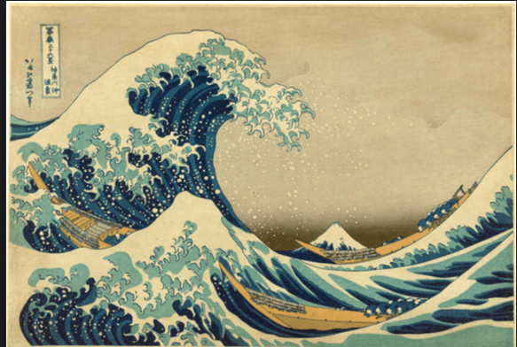
“The Great Wave off Kanagawa,” by Katsushika Hokusai
According to the USGS, 81% of the world’s largest earthquakes occur along the Circum-Pacific Seismic Belt, known in popular culture as the “Ring of Fire.” Stretching from the eastern shores of Asia to the western shores of the Americas, the Ring unites the hemispheres through a dangerous and active series of plates, faults, and seismic activity. But, which of those plates could produce an earthquake powerful enough to send a tsunami to the shores of Japan, but far enough away for the earth not to shake under her inhabitants’ feet? The answer to this doesn’t only fulfill a historical question, but it provides a modern solution: knowing where powerful quakes originate helps save lives.
As geologists delved further into the concept of plate tectonics in the 1960s, they discovered that some regions are more capable of producing massive, “megathrust” earthquakes that can register high on the Richter scale and precipitate massive damage. The obvious choice for the origin of such a quake would be the around the Aleutian Arc, relatively close to Japan and a known site of active earthquakes. Still, as geologist Brian Atwater points out in his comprehensive study of the quake, The Orphan Tsunami of 1700, Alaska isn’t a good source. When a massive, 9.2 quake originated from there in 1964, residual tsunami waves in Japan weren’t close to as numerous or powerful as the reports from 1700. Further geological studies of soil deposits placed the last quake of that magnitude there to somewhere around the year 1200, ruling Alaska out completely.
But there was another area of the Pacific Northwest, long thought to be incapable of producing megathrust quakes, that was yielding some interesting results. In the mid-1980s, Atwater and other geologists discovered evidence that the land along the Cascadia region (from Vancouver, B.C. to Northern California) had dropped. Tidal mud and sand were found in layers under solid ground, and the stumps of dead cedar and spruce trees lay buried underneath layers of sediment forming “ghost forests”. Dendrochronologist David Yamaguchi was able to analyze the rings of the dead trees and determine that they were alive until at least 1699, and radiocarbon dating placed the event from 1695-1720. Whatever happened in Cascadia happened quickly -archaeological sites unearthed in the later part of the 20th-century show woven baskets and rocks from encampments completely buried under deposited earth and sand.
It seemed as if science was producing important clues, but historians were unable to verify them through records. The Cascadia of 1700 was a world that would be virtually untouched by Europeans for over 100 years until the Lewis and Clark expedition made it’s way to Fort Clatsop in the winter of 1805. The native tribes did not have written language, so no documents exist that can verify the existence of a massive earthquake, However, research scientist Ruth Ludwin and others documented oral traditions telling of floods, quakes, and a battle royale between a Whale and Thunderbird – the water and the earth.
In the mid-90s, Japanese research teams with the National Institute of Advanced Industrial Science and Technology and the University of Tokyo put all the pieces together. Transferring traditional Japanese time and date keeping from local zasshos (logs which recorded daily conditions in each magistrate), accounting for differences in longitude, and the nearly 5,000 miles the tsunami would have to travel, the Japanese team established not only a date, but a time. At 9 p.m. on January 26th, a massive quake struck the Cascadia region, probably just around 9.0 on the Richter scale. Ten hours later, its tsunami hit the shores of the eastern prefectures of Japan.
The date determined by Japanese record keeping from 1700 matched perfectly with geological evidence unearthed centuries later, and local folklore that had been passed on for generations. It proved that the Cascadia subduction zone was and likely still is capable of producing destructive and powerful quakes. It’s not only a piece of the puzzle, but a warning for the future.
This mysterious piece of history was finally solved, thanks to the scientific and anthropological evidence that supported a bold hypothesis and provided the answer to a centuries-old question as to what probably happened.
